WhiteBlaze Pages 2024
A Complete Appalachian Trail Guidebook.
AVAILABLE NOW. $4 for interactive PDF(smartphone version)
Read more here WhiteBlaze Pages Store

Page 2 of 2 FirstFirst 1 2
Results 21 to 33 of 33

Thread: Mt. Moosilauke

  1. #21
    Registered User Undershaft's Avatar
    Join Date
    08-03-2005
    Location
    Broadcasting in Stratovision
    Posts
    290
    Images
    168

    Default

    Quote Originally Posted by Lion King View Post
    The sign was there but it wasnt visible in the weather.

    I have sinced hiked the Moose probably 50 times or more. I used to work at Lost River Gorge and would hike beer and food up to the shelter and then hike over to Packrats to jam some guitar for the weekend, then hike back to my house in Lincoln.

    I miss NH.

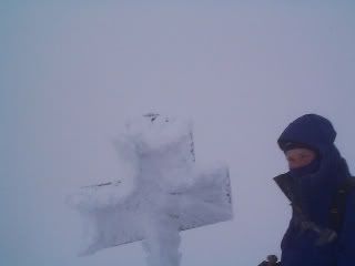
    Yeah, looking at my photos, the sign at the intersection of the Beaver Brook trail(AT) and Benton trail is painted brown. If you were hiking with your head pointed down (likely in nasty weather) you could walk right by it. Must have been nice to work right at the base of the mountain. Moosilauke is one of my favorite summits.
    Mobilis in Mobili

  2. #22
    Registered User Undershaft's Avatar
    Join Date
    08-03-2005
    Location
    Broadcasting in Stratovision
    Posts
    290
    Images
    168

    Default

    Quote Originally Posted by ChinMusic View Post
    My buddy did say the weather was poor, "once above treeline, enough wind to knock me off my feet twice".

    I would think a GPS would be better than a map for this type of problem. I could see the AT on my GPS and it would be obvious to me in short order if I was going the wrong way. With a map, in poor visibility, I still would be guessing for awhile.
    You're probably right about a GPS in situations of very poor visibility. And it does get windy up there. I've been hit by gusts in the Presidentials that slapped me and my pack down like wheat before a scythe.
    Mobilis in Mobili

  3. #23
    Geezer
    Join Date
    11-22-2003
    Location
    Portsmouth, NH
    Age
    76
    Posts
    2,964

    Default

    Quote Originally Posted by Undershaft View Post
    Your buddy was wrong, All the trails on Moosilauke are clearly marked by signs.
    Yeah, I never heard of anyone ever getting lost in the Whites anywhere.

    Easy to get turned around on Moosilauke. Best thing is to do what his buddy did. Turn back and make sure you're on the right trail.

    Keeping going because you THINK the trail marking was clear is a great way to go down the wrong trail.
    Frosty

  4. #24
    Registered User Undershaft's Avatar
    Join Date
    08-03-2005
    Location
    Broadcasting in Stratovision
    Posts
    290
    Images
    168

    Default

    Quote Originally Posted by Frosty View Post
    Yeah, I never heard of anyone ever getting lost in the Whites anywhere.

    Easy to get turned around on Moosilauke. Best thing is to do what his buddy did. Turn back and make sure you're on the right trail.

    Keeping going because you THINK the trail marking was clear is a great way to go down the wrong trail.
    I disagree. The sign clearly marks the TWO trails that converge on the summit. If you can't read a sign and follow the arrows, you will get lost anywhere. The sign is even easier to read and follow now, based on the photos. The two trails are perpendicular to each other. One is clearly labeled as the AT the other is not. In order to lose the trail you have to climb over a big pile of rocks and descend steeply in a totally different direction. To stay on the AT you just keep going straight.

    Yeah, people get lost in the Whites. But the intersection on the summit of Moosilauke is very easy compared to other places in the Whites. It's not like Thunderstorm Junction or Tuckerman Junction where you have five different trails radiating in five different directions. If you are heading nobo over Moosilauke, you either continue straight on the AT or you turn right ninety degrees onto the Gorge Brook trail.
    Mobilis in Mobili

  5. #25

    Default

    Quote Originally Posted by Colonel Chaco View Post
    Ill let you know tommorow after i go over it!
    chaco i hope you have good weather thru the whites and southern maine. the descent down moosehawkie is awesome. please tell packrat hello for me. and that i'll see him next year... thanks peace

  6. #26
    But I believe, yes I believe, I said I believe
    Join Date
    09-24-2006
    Location
    Between Kittery and Fort Kent
    Age
    33
    Posts
    2,576
    Images
    3

    Default

    I was socked in on the summit and had no trouble finding my way, but I could see how you could loose trail if you are not paying attention to the signs.

    In the Whites, you need to read all trail junction signs to see which path the AT takes. There are spots where the AT makes a sharp turn while another path continues in the same general direction you are going.

    Kirby

  7. #27

    Default

    Quote Originally Posted by ChinMusic View Post
    My buddy did say the weather was poor, "once above treeline, enough wind to knock me off my feet twice".

    I would think a GPS would be better than a map for this type of problem. I could see the AT on my GPS and it would be obvious to me in short order if I was going the wrong way. With a map, in poor visibility, I still would be guessing for awhile.
    Correct! Here's what it looked like last time i was up there.
    I knew pretty much which way to go having been there 3 or 4 times previously but it was still heavy winds and some guess work.
    If you had the trail already on your GPS, it should tell you if you are going to right way or not. Even in fog and heavy wind.

    Yes a map would tell you also (with your compass) but these were probably 50+ mph winds this day and i don't see how you could get your map out in that weather. Just get below treeline and hunker down and attempt to figure it out.

  8. #28
    Registered User
    Join Date
    09-13-2007
    Location
    Buladean, NC
    Age
    59
    Posts
    807

    Default

    This sign says "all trails go left".


  9. #29
    Registered User wakapak's Avatar
    Join Date
    07-23-2006
    Location
    NH
    Age
    48
    Posts
    2,432
    Images
    3

    Default

    In NH while hiking that AT, it's best to know the names of that trails that AT takes, and to have the maps with you. if you pay attention to the names of the trails, then you won't get lost.

  10. #30

    Default

    AWWWWWW YEA Baby, its on!!!!

  11. #31
    Registered User
    Join Date
    08-11-2005
    Location
    New England
    Age
    58
    Posts
    245
    Images
    240

    Default

    Quote Originally Posted by ChinMusic View Post
    How easy it it for a NOBO to make a wrong turn after summitting Mt. Moosilauke? A buddy of mine said it wasn't well marked up there and he took the wrong path for about half a mile and had to resummit.
    As a new AT hiker, a long time ago, at 2 months into a 3 month section hike I lost the trail on Mt. Moosilauke. The fog rolled in fast, and dusk fell quickly as a lightning storm blew in from the west. I just couldn't see anything anymore. I sort of slept on top of Mt. Moosilauke next to a pile of rocks, in 60 mph winds, rain and truly scary close lightning strikes. I only hoped hypothermia acted slowly as I waited shivering for dawn.

  12. #32
    Registered User ChinMusic's Avatar
    Join Date
    05-22-2007
    Location
    Springfield, Illinois, United States
    Age
    65
    Posts
    6,384

    Default

    Quote Originally Posted by refreeman View Post
    As a new AT hiker, a long time ago, at 2 months into a 3 month section hike I lost the trail on Mt. Moosilauke. The fog rolled in fast, and dusk fell quickly as a lightning storm blew in from the west. I just couldn't see anything anymore. I sort of slept on top of Mt. Moosilauke next to a pile of rocks, in 60 mph winds, rain and truly scary close lightning strikes. I only hoped hypothermia acted slowly as I waited shivering for dawn.
    Note to self: Get an EARLY start on this section.
    Fear ridges that are depicted as flat lines on a profile map.

  13. #33

    Default

    Quote Originally Posted by refreeman View Post
    ...I sort of slept on top of Mt. Moosilauke next to a pile of rocks, in 60 mph winds, rain and truly scary close lightning strikes. I only hoped hypothermia acted slowly as I waited shivering for dawn.
    Did you sleep near these rocks on top of Mt Moosilauke

    Also there's a pic of the trail, headed north, looks easy, but I wouldn't want to follow it in heavy fog.

    And another pic of the sign.

Page 2 of 2 FirstFirst 1 2
++ New Posts ++

Posting Permissions

  • You may not post new threads
  • You may not post replies
  • You may not post attachments
  • You may not edit your posts
  •