WhiteBlaze Pages 2024
A Complete Appalachian Trail Guidebook.
AVAILABLE NOW. $4 for interactive PDF(smartphone version)
Read more here WhiteBlaze Pages Store

Results 1 to 17 of 17
  1. #1
    Registered User
    Join Date
    11-30-2010
    Location
    Atlanta, GA
    Age
    40
    Posts
    49

    Default Amicalola to Neels Gap

    Looking for a nice Labor Day hike and after grossly underestimating the difficulty of doing 15/day last December I'm looking for some honest and reasonable feedback on the schedule below:

    Starting at Amicalola (still debating on doing the stairs) ending points would be:

    Day 1 - Three Forks
    Day 2 - Gooch Mountain Shelter
    Day 3 - Jarrard Gap
    Day 4 - Neels!!!

    Also, checked Mountain Crossings but the Water Status page doesn't appear to be working. Anyone know status of water along the trail? I hiked part of Bartram last weekend and was amazed how low it was.

  2. #2
    Stir Fry
    Join Date
    11-30-2007
    Location
    Concord North Carolina
    Age
    65
    Posts
    677

    Default

    You should be ok with that sdhedule. My wife did somthing like it a couple of years ago. we started at the Hike Inn 1st day to Hawk Mt 2ed day to Goosh Mt. 3ed day to Woods Hole. Last day to Neel Gap. This was only her second kike and did fine.
    If it do'nt eat you or kill you it makes you stronger
    'The true soldier fights not because he hates what is in front of him, but because he loves what is behind him.' G. K. Chesterton

  3. #3
    Registered User ChinMusic's Avatar
    Join Date
    05-22-2007
    Location
    Springfield, Illinois, United States
    Age
    65
    Posts
    6,384

    Default

    I had a similar itinerary a few years ago. It was well balanced mileage wise. You will need to plan water sources closely for the last two days.
    Fear ridges that are depicted as flat lines on a profile map.

  4. #4
    Registered User Sierra Echo's Avatar
    Join Date
    05-17-2010
    Location
    Buford, Georgia
    Posts
    1,615
    Images
    23

    Default

    Well its suppose to pour and thats gonna make blood mtn slick, so be careful!

  5. #5
    Registered User
    Join Date
    11-30-2010
    Location
    Atlanta, GA
    Age
    40
    Posts
    49

    Default

    Not what I wanted to hear. I checked the forecast a few days ago and it looked good. Now I see it shows isolated thunderstorms. Hopefully not isolated over me. :-(

    At least it's my last day... I'll bring a pack cover but may skip the rain gear entirely... although a poncho wouldn't hurt.

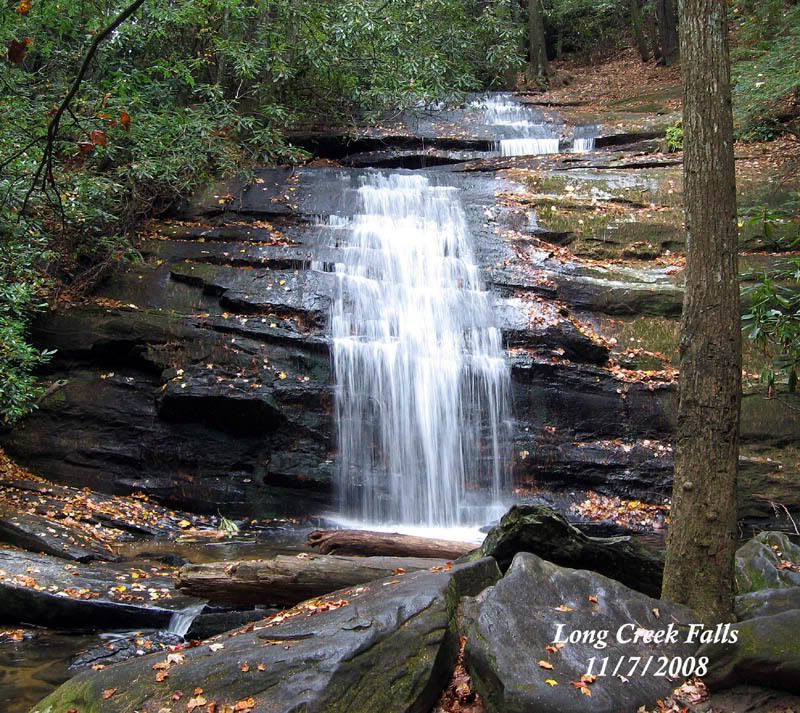
    On a side note - do you think it would be better to camp at Long Creek Falls the first night? I know the water may be mighty cold but a dip after such a long day would be nice...

  6. #6
    Registered User Sierra Echo's Avatar
    Join Date
    05-17-2010
    Location
    Buford, Georgia
    Posts
    1,615
    Images
    23

    Default

    Isolated storms? According to the AJC its gonna monsoon.

    http://www.ajc.com/news/holiday-week...n-1152286.html

    Long Creek falls should be fine. Its not suppose to start raining til Sunday night or so. And as for rain gear, other then my pack cover I don't fool with it.

  7. #7
    Registered User ChinMusic's Avatar
    Join Date
    05-22-2007
    Location
    Springfield, Illinois, United States
    Age
    65
    Posts
    6,384

    Default

    Quote Originally Posted by High Jacker View Post

    On a side note - do you think it would be better to camp at Long Creek Falls the first night? I know the water may be mighty cold but a dip after such a long day would be nice...
    Def have Long Creek Falls as an option. It is a beautiful place....

    Fear ridges that are depicted as flat lines on a profile map.

  8. #8
    Registered User
    Join Date
    11-30-2010
    Location
    Atlanta, GA
    Age
    40
    Posts
    49

    Default

    When I look at Blairsville in Weather.com it shows isolated... Definitely not what I wanted to see but could be fun. :-)

  9. #9
    Registered User Sierra Echo's Avatar
    Join Date
    05-17-2010
    Location
    Buford, Georgia
    Posts
    1,615
    Images
    23

    Default

    I look at NOAA. Its by far the most accurate:

    http://forecast.weather.gov/MapClick...6&lon=-83.9516

  10. #10
    Registered User
    Join Date
    11-30-2010
    Location
    Atlanta, GA
    Age
    40
    Posts
    49

    Default

    LOL. Looks like I'm in for a swim!

  11. #11
    Registered User
    Join Date
    11-30-2010
    Location
    Atlanta, GA
    Age
    40
    Posts
    49

    Default

    Hey do you know of any updated water info anywhere online?

  12. #12
    Registered User Sierra Echo's Avatar
    Join Date
    05-17-2010
    Location
    Buford, Georgia
    Posts
    1,615
    Images
    23

    Default

    I don't think there is very much. You could call mountain crossings and ask them if they have heard. Last I heard it was dry all the way to three forks. And that hikers who were hiking the section you are doing were having to hike down to Lake Winfield Scott to get water.

  13. #13
    Registered User
    Join Date
    05-10-2010
    Location
    Jupiter, FL
    Posts
    48

    Default

    I did that same trip last Oct. Love Amicalola Falls. Camped in the park 1st day and hiked stairs without pack to Lodge for dinner. Next day, parked at the Lodge (top of stairs) and started Approach Trail to Neels Gap. Coming from flat Florida made the 1st day a challenge for me, so I camped at Springer (7.8 miles), then Day 2 near Hightower Gap, Day 3 at Ramrock, Day 4 at Woods Hole shelter, then Neels Gap early next day where Cool Breeze brought me back to Amicalola Falls.

    It was also dry that year, but my only section of water shortage was around Woody Gap. Tank up at Lance Creek if its dry.

  14. #14
    Registered User
    Join Date
    05-10-2010
    Location
    Jupiter, FL
    Posts
    48

    Default

    Quote Originally Posted by High Jacker View Post
    LOL. Looks like I'm in for a swim!
    Courtesy of tropical storm Lee
    http://www.nhc.noaa.gov/graphics_at3...daynl#contents

  15. #15
    Registered User FatMan's Avatar
    Join Date
    01-28-2004
    Location
    Grassy Gap - AT
    Age
    66
    Posts
    1,280

    Default

    Probably a bit late since you are most likely already out hiking but I've spent the last two days checking water from Hawk Mtn to Neels. Things are looking a bit better, but that's not to say it is good. It was very bad the past couple of weeks.

    Hawk - running slow but accessible

    Justus and Blackwell creeks - good

    Gooch Mtn Shelter - slow but good

    Spring south of Gooch Gap - nearly dry but water can be gotten to the right of the footlog on the north side.

    Gooch Gap - running slow but no problem

    Grassy Gap - very slow - Gooch easier

    Woody Gap - near dry, just a small puddle with a frog in it, but with patience you could get maybe a liter as long as someone was not there within an hour or two. Oh the frog jumped out when I got close.

    Lance Creek - Good. Clearly the person who told me last week it was dry was an idiot.

    Jarrard Gap - down the Jarrard Gap trail 1st spring dry, 2nd spring just a small puddle like Woody Gap (no frog :lol). About 400 yds you will cross a footlog and water is available another 20 yds down to the right.

    Woods Hole - Dry

    Spring at Slaughter Creek trail - Dry. I did not go down the Slaughter creek trail to see how far to water. Get at enough at Lance Creek or Jarrard gap to get to Neels.

    I do not know about water on the Approach. I have had many confirm that Springer is Dry. I have not been there in a while. The big creeks Stover and Long never go dry.

    Good luck. BTW, it is the hottest it has been all year out there yesterday and today. I ran into many hikers who looked like they were in hell, me included today and I was only carrying a day pack with lots of water.

  16. #16

    Default

    Quote Originally Posted by FatMan View Post
    Probably a bit late since you are most likely already out hiking but I've spent the last two days checking water from Hawk Mtn to Neels. Things are looking a bit better, but that's not to say it is good. It was very bad the past couple of weeks.

    Hawk - running slow but accessible

    Justus and Blackwell creeks - good

    Gooch Mtn Shelter - slow but good

    Spring south of Gooch Gap - nearly dry but water can be gotten to the right of the footlog on the north side.

    Gooch Gap - running slow but no problem

    Grassy Gap - very slow - Gooch easier

    Woody Gap - near dry, just a small puddle with a frog in it, but with patience you could get maybe a liter as long as someone was not there within an hour or two. Oh the frog jumped out when I got close.

    Lance Creek - Good. Clearly the person who told me last week it was dry was an idiot.

    Jarrard Gap - down the Jarrard Gap trail 1st spring dry, 2nd spring just a small puddle like Woody Gap (no frog :lol). About 400 yds you will cross a footlog and water is available another 20 yds down to the right.

    Woods Hole - Dry

    Spring at Slaughter Creek trail - Dry. I did not go down the Slaughter creek trail to see how far to water. Get at enough at Lance Creek or Jarrard gap to get to Neels.

    I do not know about water on the Approach. I have had many confirm that Springer is Dry. I have not been there in a while. The big creeks Stover and Long never go dry.

    Good luck. BTW, it is the hottest it has been all year out there yesterday and today. I ran into many hikers who looked like they were in hell, me included today and I was only carrying a day pack with lots of water.
    You da "FAT"man brother... Gave water to Firefly and her friend today @ Woody... They were TOTALLY out and still had to make it to Neel... Woody was dryer than a Popcorn fart...

  17. #17
    Registered User
    Join Date
    11-30-2010
    Location
    Atlanta, GA
    Age
    40
    Posts
    49

    Default

    FatMan: That's some awesome info, thank you... if only I had seen it in time. :-/

    All things said, trip was fantastic! Brief trip report below:

    Day 1 - Started at Amicalola ABOVE the falls. I would have done the stairs but my hiking buddy didn't want to and as I'd done them before I didn't push the issue. I'm glad I didn't. We ended up hiking (as planned) to Long Creek Falls. Falls were very low, just enough to get the feet wet, though it was quite refreshing.

    Day 2 - At Long Creek Falls, we heard various reports about the water situation N of us. The only *confirmed* report was Gooch Mtn Shelter. Filled up with 3L prior to Gooch Mtn Shelter (it was too much, but I wanted the safety net - plus I could've cooked for lunch and still been fine). We skipped Hawk entirely but did stop at Justus for a quick bite and filled what we had drank so far. We got to Gooch Mtn Shelter and met a nice girl hiking with her father. The girl had done a SOBO hike last year and had some interesting stories. I topped off at Gooch Mtn Shelter with a ridiculous 4L as we were planning to camp somewhere between that and Lance Creek (next reliable source) and I'm glad I did.

    Day 3 (Today). It rained. A lot. We camped about 2 miles south of Woody...After having fallen asleep at 7:30 the night before, we were wide awake by 3:45. We decided to break camp (in the rain - not fun for a hammock sleeper like myself) and set off at about 5:00. Slowed by the darkness, rain, and fog, it took us an hour to get to Woody. We stopped at Woody for hot meal and left around 7. When we got to Lance Creek, it was running, but as it had been pouring for hours by the time we got there and the water was not great. I was OK on water so I kept on, my buddy grabbed a liter of extremely dirty water (attempts at filtering through a bandana did little) which he ended up not even needing.

    I must say, this is the first time I've gone Blood Mtn>Neels, having only done a day hike from Woody>Blood previously. Those rocks were a bit of a challenge in the rain. If it were below freezing, I honestly don't know how one would go down them.

    All things said, the water situation wasn't terrible, it just required me to carry far more than I'm comfortable with. I'd much rather travel with 1.5 or so and top off more frequently so as to save weight. Nevertheless, a great trip. Appreciate all the advice!

++ New Posts ++

Posting Permissions

  • You may not post new threads
  • You may not post replies
  • You may not post attachments
  • You may not edit your posts
  •