WhiteBlaze Pages 2024
A Complete Appalachian Trail Guidebook.
AVAILABLE NOW. $4 for interactive PDF(smartphone version)
Read more here WhiteBlaze Pages Store

Results 1 to 13 of 13
  1. #1
    Getting out as much as I can..which is never enough. :) Mags's Avatar
    Join Date
    03-15-2004
    Location
    Colorado Plateau
    Age
    49
    Posts
    11,002

    Default A little Hayduke Trail teaser...

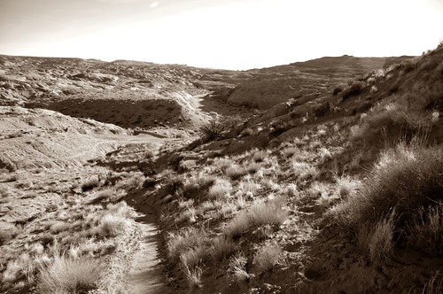
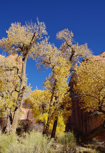
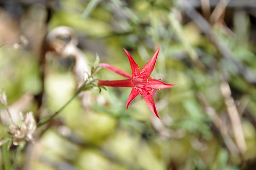
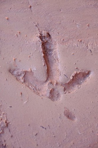
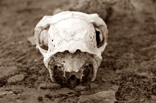
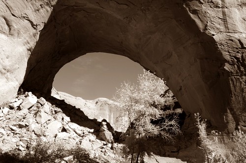
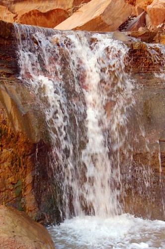
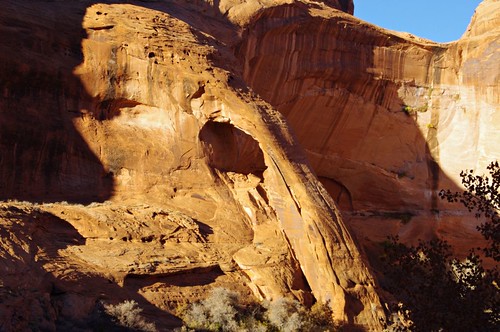
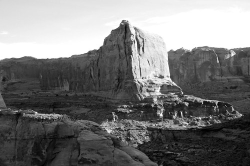
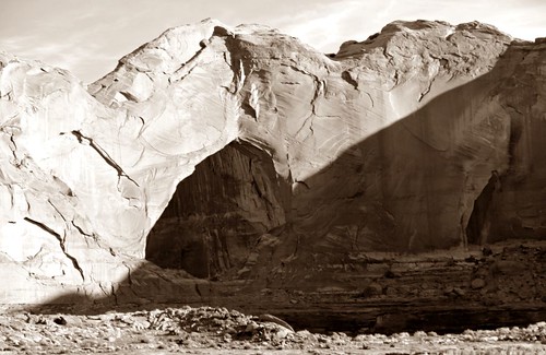
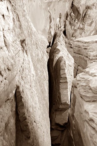
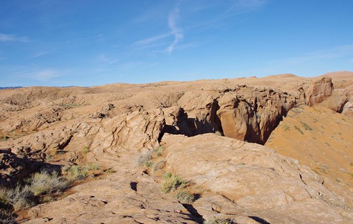
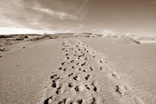
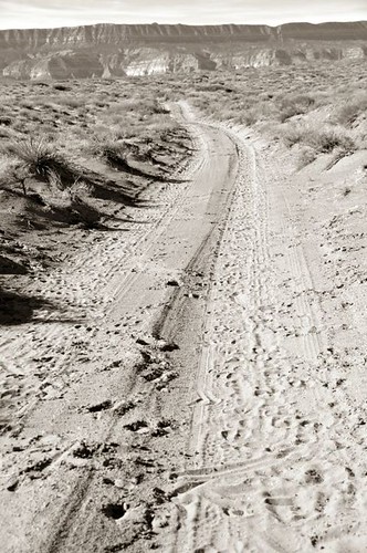
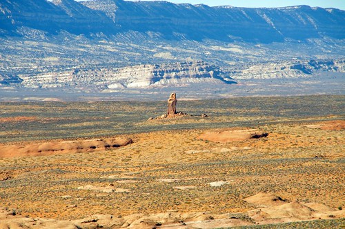
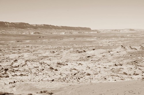
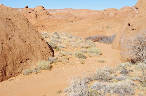
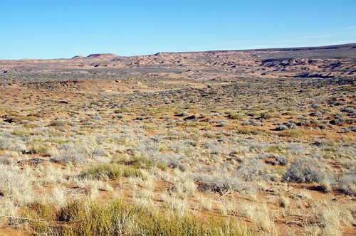
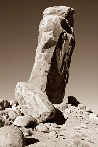
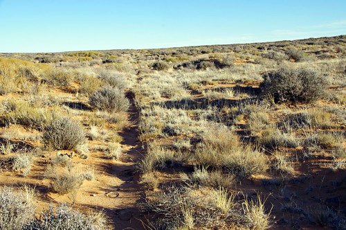
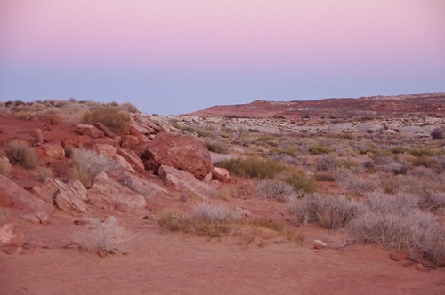
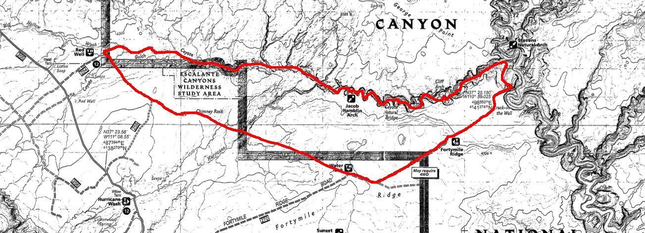
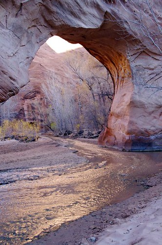
    Nah, I did not thru-hike it. But, been all over many of its places in the past decade. Revisted one of my favorite parts of it this past weekend:


    The canyon country of Utah is simply one of the most gorgeous places in the US.

    More to follow...
    Paul "Mags" Magnanti
    http://pmags.com
    Twitter: @pmagsco
    Facebook: pmagsblog

    The true harvest of my life is intangible...a little stardust caught,a portion of the rainbow I have clutched -Thoreau

  2. #2

  3. #3

  4. #4

    Default

    AHHHHH, Escalante Grand Staircase. ARRRR, WOOOO, I love coyotes! LOL.

  5. #5

    Default

    The Hayduke Trail. Wow, is that a misnomer. It should more apprpriately be labeled a ROUTE that sometimes follows a trail!

  6. #6
    Getting out as much as I can..which is never enough. :) Mags's Avatar
    Join Date
    03-15-2004
    Location
    Colorado Plateau
    Age
    49
    Posts
    11,002

    Default

    Quote Originally Posted by Dogwood View Post
    The Hayduke Trail. Wow, is that a misnomer. It should more apprpriately be labeled a ROUTE that sometimes follows a trail!
    I hear ya..I tend to like routes the past few years. Grab a map, a compass and plot out what looks good.

    We plan on featuring the HDT on our next Trailshow podcast. Our guest panelist has done the HDT and we are reviewing a book about Everett Ruess.
    Paul "Mags" Magnanti
    http://pmags.com
    Twitter: @pmagsco
    Facebook: pmagsblog

    The true harvest of my life is intangible...a little stardust caught,a portion of the rainbow I have clutched -Thoreau

  7. #7

    Default

    Based on what I know about you and what you've said above I think you would love the HDT. It would make a GREAT addition to your already impressive hiking resume. Might even get me back out there to drop off some resupplies for you and hike some sections with you too. Could there be a "Quick and Dirty Guide to Hiking the HDT" in Mag's future?

  8. #8
    Getting out as much as I can..which is never enough. :) Mags's Avatar
    Join Date
    03-15-2004
    Location
    Colorado Plateau
    Age
    49
    Posts
    11,002

    Default

    HEre's the trip report..Q&D HDT Guide? Maybe..just maybe.

    Coyote Gulch is a classic backpacking trip in the Grand Staircase-Escalante National Monument. Here is my trip report of an ~28 mile loop I did there over Thanksgiving Weekend.

    Ask for the ancient paths where the good way is and walk in it and find rest for your souls.
    –From an ancient text by a nomadic desert tribe
    Ask a multitude of outdoors people some favorite places and invariably certain names always come up. Places like The Winds. Or the High Sierra. Glacier. The San Juans. The Whites.
    And one place that always seems to be named with an almost sound of awe and reverence in their voice? The red rock and canyon country of the Colorado Plateau.
    When talking about this place, many people get a glow to their eyes.
    Stark red hoodoos are remembered. Memories are recalled of walking along an arid plain above and then discovering a lush world below the canyon rim. A place with flowing rivers, grass and cottonwoods swaying in the breeze and deer grazing. A land where we walk in the footsteps of ancient people.
    It is truly a unique place. A place that a lifetime is not enough to explore.
    And since my first trip there over ten years ago, it is a place where I always long to return.
    When I had some extra time to spend over Thanksgiving weekend (and Mrs Mags wanting to do schoolwork), I immediately plotted my escape into Utah. The first place that came to mind was where I fell in love with canyon country so long ago: Coyote Gulch.
    I did it as a day hike then but always wanted to do it as a backpacking trip.
    So this year I did. Poured over the map. Plotted out a loop. Packed my gear and off I went.
    The miles ticked by as I left the foothills around Boulder and crossed the Continental Divide. The high mountains again receded to foothills and then around Grand Junction, the red rock country finally began. Utah was crossed into and I winded my way through the lonely roads with its stark terrain. I finally arrived just at dusk and pulled up to the Red Well TH. A quick truck bivvy was done and I settled in for the night.
    In the morning, I saw a lone gentleman that had arrived overnight. We only said hello to each other briefly. I think we both respected the solitude we each came out here for. Small talk was not something we were seeking.
    Instead, I quietly gazed over the terrain I'd be walking as I sipped some coffee. The sun was up, the air was cool and I did not want to be anywhere else.
    After my breakfast, the pack was hoisted.
    The trip had truly begun.
    I entered the dry wash with its worn path leading further into the gulch.

    What was a trickle of water near the entrance of the canyon started flowing more.
    The stark landscape of above gave way to cottonwoods still showing late Fall color and Scarlet Gila showing an intense red.


    Deer was seen and even spotted some wild turkey tracks.


    Pushed further into the canyon. The flow increased and the walls became steeper.
    Jacob-Hamlin Arch was spotted.

    The canyon was further pushed into and around the corner of a canyon wall, perhaps the most famous landmark of the gulch was spotted: Coyote Natural Bridge.
    Fu
    The red sandstone, the flowing streams and the way the light is reflected off the graceful curves of the formation makes this place a memorable one.
    Further along the canyon I went. More arches were spotted and the red walls continued to get ever higher and more sheer. The water gained force as it came closer to its confluence with the Escalante River.


    Shortly before this confluence and right around where I was to exit the canyon, the day was starting to grow short.
    Luckily, I found an alcove above the stream that was perfect camp for the evening.
    The following morning, I made my way up the canyon and back to the rim.
    Some last looks were had to the rock walls and Stevens Arch.


    The Crack was reached and I squeezed through with my pack over my head.

    The canyon rim was reached and a cairned red rock route was discovered.

    When the cairns stopped, a well-worn use trail lead back to the TH.

    At the 40 Mile Ridge TH, I did a short road walk before the true off trail hiking began.

    I left the jeep road and began hiking cross-country to Chimney Rock.

    The non-zoomed photo gives a better view of the expanse of the area:

    A sea of red rocks were crossed as I made my way along by compass to where Chimney Rock would be located.

    Briefly dipped into Hurricane Wash…

    …and arrived at Chimney Rock.
    Took one last look back to where I've been:

    Chimney Rock proved to be a great place to pause and take in the scenery before making the final push back to my vehicle.

    Briefly followed a jeep road again and started to head cross country.
    Much to my surprise, an old jeep track appeared. And it headed in the direction where I wanted to go. The old cattle dung lead the way!

    The car was reached shortly before dusk. A cold beer was enjoyed as I simply sat and took in the day starting to turn into night and thinking about the trip I just had.

    Two more days would be had among the red rocks.
    But these past two days would be hard to top. Not only for this trip, but for trips to come.
    I will be back again.
    TRIP DETAILS
    Getting There: This link from Summitpost has good directions. I'd just add to make sure you have a full tank of gas before heading down Hole In The Rock Road. The town of Escalante is less than 5 miles away. Boulder, UT has a 24 hr gas station available.
    Speaking of Hole In The Rock Road, it is very wash-boardy. A A 2WD passenger vehicle should be able to make it to the Red Rock Well TH if conditions are dry. I saw a Prius at the TH. The going will be slow, though.
    The Route: Red Well TH > Coyote Gulch > out at The Crack > 40 Mile Ridge TH > The Watertank TH > x-country to Chimney Rock and then x-country to Red Well TH. +/- 28 mi RT
    Here's a rough trace on the map. (Not to be used for navigation, but for reference only)

    Navigation: I used TI Map 710: Canyons of the Escalante and some printed topos for more detail. For general navigation, the TI map was fine. Coyote Gulch is very easy to follow. The Crack was easy to find as there is an obvious path going up from the canyon floor. From the rim to 40 Mile Ridge TH, there is an obvious social trail. To get to Chimney Rock from The Watertank is super easy. You can spot if most of the way once over the ridge crest and a compass bearing is easy to follow in this open terrain in any case. Once at Chimney Rock, look for the old jeep track that almost leads all the way back to the Red Well TH. It was almost identical to the compass bearing I was going to follow. A GPS is not needed at all IMO.
    Crack-in-the-Wall: Different websites really play up the difficulty of this exit. It ain't that bad IMO. If you have a lighter pack and are conditioned, the climb is steady but not overly difficult. As for the crack itself, it is narrow and the pack probably has to be taken off. But, again with a light pack, easy enough to lift over the head as you squeeze through the canyon wall.
    Water: Plenty of water in the gulch. After that, 1 liter per 5 miles is a conservative figure for most people in temperate to very warm conditions. Plan accordingly when carrying out of the canyon. I did see a solar well along the way to The Watertank, but I am not sure because this bull dissuaded me :
    Paul "Mags" Magnanti
    http://pmags.com
    Twitter: @pmagsco
    Facebook: pmagsblog

    The true harvest of my life is intangible...a little stardust caught,a portion of the rainbow I have clutched -Thoreau

  9. #9

    Default

    Feed my addiction. I love the desert and the mountains and the deep woods and the rain forests and....

  10. #10

    Default

    If you like Coyote Gulch, and who wouldn't, Sect 6 of the HDT, from Lower Muley Twist Canyon TH in Capitol Reef NP past The Tanks to Hall's Creek along the Water Pocket Fold up and over Red Slide down to Middle Moody Canyon to the confluence with the Escalante River AND then following the HDT which is the same as following the Escalante River by wading in the Escalante River(the river is the trail!) for 22 miles down to its confluence with Coyote Gulch and then taking Coyote Gulch to Hurricane Wash or to the Red Well Th is a must do. It's about a 75 mile trek which includes the short side trip to Halls Arch as well as hiking by and/or under the arches in your pics. You'll get unprecedented adventure, solitude, unspoiled red rock scenery, plenty of room for additional exploration, and a in the desert 22 mile long 300 + ft high vertical canyon walled wade thrown in for added measure. Beware though of possible flash floods, deep cold swift running spring run-off conditions in the river, possible extreme heat, and the remoteness of the entire trek! Throw in Grosvenor Arch at the end of your trek in Escalante Grand Staircase down Hole in the Rock Rd. and, well, that's a trek that will last into eternity.

  11. #11

    Default

    Stunning beauty... thanks for sharing, Mags! It's so different from what we are used to looking at on the East Coast. I'm a believer.............

  12. #12
    Digger takethisbread's Avatar
    Join Date
    08-11-2009
    Location
    Massachusetts
    Posts
    1,062
    Journal Entries
    1

    Default

    Thanks for sharing. I was out there a few years ago. It's quite striking. I'm not sure it's a trail I'd want to thru hike but its amazing country for sure . It's good country for working on your map and compass skills

  13. #13

    Default

    Part of me is really tempted to try a HDT thru right after a hypothetical completion of my 2013 AT thru.

++ New Posts ++

Posting Permissions

  • You may not post new threads
  • You may not post replies
  • You may not post attachments
  • You may not edit your posts
  •