WhiteBlaze Pages 2024
A Complete Appalachian Trail Guidebook.
AVAILABLE NOW. $4 for interactive PDF(smartphone version)
Read more here WhiteBlaze Pages Store

Results 1 to 17 of 17
  1. #1
    Registered User q-tip's Avatar
    Join Date
    02-04-2009
    Location
    Richmond, VA
    Age
    68
    Posts
    1,034
    Images
    54

    Default JMT-Do You Need A GPS??

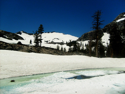
    I am severely directionally challenged, I get lost between blazes regularly. Question, will I need a GPS for the JMT starting next July 1. Also, any thoughts on using a Wild Oasis tarp vs. a Tarp Tent Contrail. Your thoughts and experience????????????????

  2. #2
    Thru-hiker 2013 NoBo CarlZ993's Avatar
    Join Date
    10-29-2010
    Location
    Austin, TX
    Age
    69
    Posts
    1,022

    Default

    If you are 'severely directionally challenged,' you might carry a GPS. The trail was pretty well marked when I last hiked it (2004). With good maps & a compass, you SHOULD be fine w/o a GPS. Personally, I always carry a GPS because I'm a geek-wanna-be. I record my campsites every night (format name = yymmdd). I've never used a GPS to plot where I was on the JMT (did it frequently on the High Sierra Route).

    Maps: Couple of options. Tom Harrison's JMT map set is pretty good. That's what I used. I recall around 13 or so 8.5 X 11" sheets. http://www.amazon.com/John-Muir-Trai...+harrison+maps
    You could also print out some of Half Miles free PCT maps. This would cover most of the JMT south of Tuolumne Meadows (except a portion between Thousand Island Lakes & Devils Postpile where the trails diverge). Half Mile's maps have a better scale for navigation. http://www.pctmap.net/download/p/mapdl.html

    Note: July 1st means you'll need to pay attention to the winter snow pack. Last year was really light. The year before had epic levels of snow in the mountains. Personally, I've always used a late July or August time frame to hike the Sierras. Worse case, you'll may have to pick up an ice ax for your hike (not likely, but possible; Mammoth Lakes Ski Resort didn't close until 4th of July that year; that's near Reds Meadows; probably day 5 or 6 on your hike, SOBO I assume).

    A Tarptent or Oasis tarp should be fine on the trail. Dependent on the snow pack, mosquitoes could be an issue in some locations along the trail. More snow = more water = more bugs.

    Use Tuolumne Meadows, Reds Meadows, & Muir Trail Ranch as your resupply locations. You will be very food heavy out of MTR.

    Have fun on your hike. I think it's the best trail hike in the US.

  3. #3
    Registered User
    Join Date
    03-06-2007
    Location
    Bellevue, WA
    Age
    67
    Posts
    2,000

    Default

    I agree with Carl --- normally I wouldn't suggest a GPS for the JMT, but based on your own sense/confidence about this, just take one anywhere, eh? The trail is still well-marked, and in addition you often have long sight lines, i.e., it's a whole lot easier to orient a map just via terrain association than it so often is in forested areas.

    For this, as well as the tent question it would be helpful to know when you plan to hike. Assuming a typical time of year (late July through early September perhaps), either of those tent options would be fine. I hiked through there in June 2008 with a Contrail and it was great. W.r.t. the Wild Oasis, I own a similar Gatewood Cape and hiked quite a lot of miles on the AT with a friend who used a Wild Oasis --- fine there too. If I had a choice and I was hiking the JMT at a typical time period I'd go with the lighter Wild Oasis, figuring that at least some of the nights I might just be able to cowboy camp, depending on bugs. My wife and I hiked the JMT in September this year with no bugs, so YMMV there.

    Of course it can rain (and rain hard) there, or be windy or both. Going with a lighter single-wall tent like that, I do suggest that this not be your first experience with such a tent, and that you pay attention to site selection late afternoons when the weather looks threatening.
    Gadget
    PCT: 2008 NOBO, AT: 2010 NOBO, CDT: 2011 SOBO, PNT: 2014+2016

  4. #4
    Registered User colorado_rob's Avatar
    Join Date
    08-20-2012
    Location
    Denver, CO
    Age
    67
    Posts
    4,540
    Images
    3

    Default

    One very good use of a GPS on the JMT is to locate campsites. I downloaded a list of a couple hundred locations with descriptions and coordinates from some website and had them uploaded into my GPS, along with a printed list of the campsite descriptions, really came in handy a few times. Also: At Reds Meadows and Tuolomne, I got seriously confused w/ all the trail options and referred to my GPS for verification at those places.

    Let me know if you'd like this campsite GPS list and I'll get it to you somehow (email? PM?). I might even be able to find the website again. Here is a list of the first 6 places. The coordinates are UTM, followed by the elevation and brief description. The "01" in "Camp 01.xx" refers to the segment, fourteen of them, starting from Yosemite and heading south. For example, that point 4 below "a little knob with room for three" really came in handy as we arrived in this area well after dark and these coordinates brought us right to a very nice little spot, in a very dense forest, that wasn't at all obvious from the trail.

    1 Camp 01.06 11S 280130 4180444 7410 Large opening south of trail
    2 Camp 01.07 11S 280340 4180617 7520 Just W of creek crossing
    3 Camp 01.08 11S 280931 4180873 7720 Along Sunrise Creek
    4
    Camp 01.09 11S 281283 4181121 7800 a little knob with room for 3
    5 Camp 01.10 11S 281270 4181251 7825 Lg opening W of creek
    6 Camp 01.11 11S 283946 4182673 8520 Nr a side creek

  5. #5
    Registered User colorado_rob's Avatar
    Join Date
    08-20-2012
    Location
    Denver, CO
    Age
    67
    Posts
    4,540
    Images
    3

    Default

    Quote Originally Posted by CarlZ993 View Post
    ... I think it's the best trail hike in the US.
    Yep, +1 on this seemingly brash statement. I've seen none better. And I've hiked a lot of trails.

    Brian Le: I wonder if our paths crossed? We did NOBO in September, finishing at Happy Isles on October 1st this year. Rained a total of 15 minutes one day (at thousand island lakes).

  6. #6

    Default

    Take the GPS, you'll enjoy the hike more. (especially in the snow)
    Don't let your fears stand in the way of your dreams

  7. #7
    Registered User
    Join Date
    03-29-2006
    Location
    Bloomington, IN
    Age
    60
    Posts
    2,018

    Default

    With no snow the trail is pretty apparent. Toitally disagree with the map and compass suggestion since most people cannot properly use a compass and if you wait until you're lost a compass isn't going to help you.

    I would use a GPS with Halfmile's GPX files. The trail is listed in, wait for it, half mile increments so you always know where you are. Just remember that the mile markers listed are PCT references and not JMT mile markers. His files also list where the JMT diverges to summit Whitney. When I went up Whitney it was always nice to know how I was progressing.
    Pain is a by-product of a good time.

  8. #8
    Registered User
    Join Date
    12-29-2011
    Location
    Worcester, MA
    Age
    46
    Posts
    91

    Default

    Quote Originally Posted by CarlZ993 View Post
    Note: July 1st means you'll need to pay attention to the winter snow pack. Last year was really light. The year before had epic levels of snow in the mountains.
    +1
    This was July 2nd, 2011 in Desolation Wilderness (PCT @ Tahoe, yes, ~150 miles north, bu Squaw Valley was open that weekend too)
    5902592244_e43c74480e.jpg

    S6300292 by scorpio516, on Flickr

  9. #9

    Default

    As long as you have a map, The Tom Harrison JMT map pack is what I recommend, you shouldn't get lost. Just actually check it when you come to a trail junction and you should be fine. The only way you'd get lost is if you assume you know which way to go instead of checking. There are a few junctions where the sign points to a feature that you know is on the JMT, but by going a different route. Check your maps. No GPS should be needed unless going in the spring when the trail is stil burried in snow.

    I thought it was far easier to get lost on the AT, at least the AMC section since they are too busy with other things to put blazes where they are actually needed, due to not carrying a real map.

  10. #10
    Thru-hiker 2013 NoBo CarlZ993's Avatar
    Join Date
    10-29-2010
    Location
    Austin, TX
    Age
    69
    Posts
    1,022

    Default

    Quote Originally Posted by colorado_rob View Post
    Yep, +1 on this seemingly brash statement. I've seen none better. And I've hiked a lot of trails.

    Brian Le: I wonder if our paths crossed? We did NOBO in September, finishing at Happy Isles on October 1st this year. Rained a total of 15 minutes one day (at thousand island lakes).
    We didn't cross trails. I did SoBo from Lake Tahoe to Tuolumne last August. I got a little bit more rain that you did. A couple days pretty hard (unusual for my previous experiences in the Sierras). In 2004, I hiked JMT SoBo in 17 days and didn't get rained on at all (late July/August).

  11. #11
    Registered User
    Join Date
    03-06-2007
    Location
    Bellevue, WA
    Age
    67
    Posts
    2,000

    Default

    Brian Le: I wonder if our paths crossed? We did NOBO in September, finishing at Happy Isles on October 1st this year. Rained a total of 15 minutes one day (at thousand island lakes).
    Perhaps so! My wife and I hiked SOBO starting the afternoon of September 8th from Happy Isles, finished Sept 24th. We took a day off at Reds Meadow. Ditto on the rain --- little to none the whole time. My wife wasn't inclined to cowboy camp, but it was perfect conditions for such. It was very cold wind blowing on the climb up Whitney but otherwise just superb weather throughout. Not that many people, no bugs, my 32F rated sleeping bag was enough --- just a wonderful trip.
    Gadget
    PCT: 2008 NOBO, AT: 2010 NOBO, CDT: 2011 SOBO, PNT: 2014+2016

  12. #12

    Default

    Quote Originally Posted by colorado_rob View Post
    One very good use of a GPS on the JMT is to locate campsites. I downloaded a list of a couple hundred locations with descriptions and coordinates from some website and had them uploaded into my GPS, along with a printed list of the campsite descriptions, really came in handy a few times. Also: At Reds Meadows and Tuolomne, I got seriously confused w/ all the trail options and referred to my GPS for verification at those places.

    Let me know if you'd like this campsite GPS list and I'll get it to you somehow (email? PM?). I might even be able to find the website again. Here is a list of the first 6 places. The coordinates are UTM, followed by the elevation and brief description. The "01" in "Camp 01.xx" refers to the segment, fourteen of them, starting from Yosemite and heading south. For example, that point 4 below "a little knob with room for three" really came in handy as we arrived in this area well after dark and these coordinates brought us right to a very nice little spot, in a very dense forest, that wasn't at all obvious from the trail.

    1 Camp 01.06 11S 280130 4180444 7410 Large opening south of trail
    2 Camp 01.07 11S 280340 4180617 7520 Just W of creek crossing
    3 Camp 01.08 11S 280931 4180873 7720 Along Sunrise Creek
    4
    Camp 01.09 11S 281283 4181121 7800 a little knob with room for 3
    5 Camp 01.10 11S 281270 4181251 7825 Lg opening W of creek
    6 Camp 01.11 11S 283946 4182673 8520 Nr a side creek
    Rob,

    You may want to zip your GPS file and post it to the JMT forum with the above example. Then PM AT Troll or Alligator and have them make it a sticky (you may be able to do this after you post until thread tools)

  13. #13
    Registered User SassyWindsor's Avatar
    Join Date
    07-19-2007
    Location
    Knightsbridge, London UK
    Posts
    969

    Default eTrex 20

    I use my eTrex 20 for auto travel and trekking. Different map sets (SDisk) used for both, naturally. I would carry one to use for emergency use or maybe for POI's I'm looking for. But as far as staying on the trail, not needed what so ever, unless you're traveling in white-out conditions then I'd probably stay held up.

  14. #14

    Join Date
    05-05-2011
    Location
    state of confusion
    Posts
    9,866
    Journal Entries
    1

    Default

    Im pretty sure a few people hiked it in the years before we even had GPS technology.

    GPS is great, but is no substitute for also knowing where you are on a real map.

    Consider it to be an aid, but do not depend on it. Its an electronic device after all, it can fail.

  15. #15
    Registered User q-tip's Avatar
    Join Date
    02-04-2009
    Location
    Richmond, VA
    Age
    68
    Posts
    1,034
    Images
    54

    Default

    Thanks for the feedback--just saved a boatload of $$$$$, and I am rethinking the start date--It seems August might be better....

  16. #16
    Registered User English Stu's Avatar
    Join Date
    04-21-2005
    Location
    Kirmington,England
    Posts
    399

    Default

    I did the JMT in 2010 it is a great trail. I would take a GPS and and only switch on if positionally challenged. The regulars say it is well signed; I don't agree the AT is well signed. JMT is nothing like that and really only marked at changes of direction with a battered tin sign, there is the odd PCT sign on a tree when the same trail is used. I got really nervous at river crossings as there can be several tracks at the other side as people dodge off for a sit down to dry off, attend natures call, with no reassuring whiteblaze.The beauty of the JMT is superb.

  17. #17
    Registered User schnikel's Avatar
    Join Date
    02-09-2009
    Location
    Columbus, Ohio
    Age
    47
    Posts
    211

    Default

    My wife and I hiked the JMT in '11. We used Eric the Black's atlas and were very pleased with it. I didn't feel a GPS was needed, and we were never lost on the trail. I would agree with others that the trail was well marked. If you are going in July, August there will be plenty of people around incase you have questions.
    Schnikel

++ New Posts ++

Posting Permissions

  • You may not post new threads
  • You may not post replies
  • You may not post attachments
  • You may not edit your posts
  •