WhiteBlaze Pages 2024
A Complete Appalachian Trail Guidebook.
AVAILABLE NOW. $4 for interactive PDF(smartphone version)
Read more here WhiteBlaze Pages Store

Results 1 to 14 of 14
  1. #1

    Default Dams near the AT

    I read this article and of course I made me think of dams on or near the AT; I'm sure Fontana is safe. However, there are other dams I'm curious if they are on some list to be removed, since that seems to be a growing trend here in America, with our roughly 85,000 dams and I think that's a good thing. BTW, there's a very small audio link and it mentions the dam destroyed on the Kennebec river and there is also a pretty cool video of an explosive detruction of another dam http://www.nature.com/news/dam-remov...he-run-1.15636


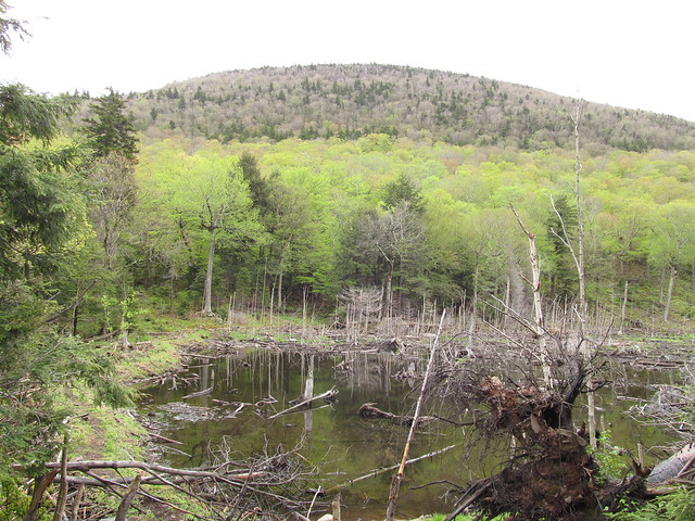
    There's a few dams out there, but it got me thinking of that dam just north of Hot Springs. I wonder if that's even on the radar; I imagine there are a lot of forgotten dams out there. Any one know of the history of that dam? Below are a couple pics from my gallery, the first is the pond created by the dam


  2. #2

    Default

    The Beaver core of engineers put this one in near Mohegan center in NJ, should it fail, (and I doubt it will) the AT would flood, and require a relocation or at least several weekends from dedicated trail maintainers.

    Culvers Gap-DWG 033.jpg

    I'm standing on the trail, which is about 2 feet below the water line.

  3. #3
    Registered User Tuckahoe's Avatar
    Join Date
    09-26-2004
    Location
    Williamsburg, Virginia
    Age
    53
    Posts
    2,320
    Images
    52

    Default

    Thanks for posting the article.
    igne et ferrum est potentas
    "In the beginning, all America was Virginia." -​William Byrd

  4. #4

    Default

    That is by far one of the neatest videos I've ever seen, can't stop watchin' it. Controld as it was, and very cool, I'd have liked to see the whole thing let go at once, like the Like in the ole WWII movie Dam Busters. Great find!

  5. #5
    imscotty's Avatar
    Join Date
    11-13-2011
    Location
    North Reading, MA
    Age
    64
    Posts
    1,272
    Images
    7

    Default

    Great video indeed. Look at all the sediment that had accumulated behind that dam. Great to see this river run free.

  6. #6

    Default

    There's a couple of dams on the Kennebec River up in Maine "near" where you have to ford that river in Caratunk. The dam north of Caratunk is Harris Station Dam. It's quite a ways north, but the flow when released from there can and will take you off your feet if you get caught in it at Caratunk. Back in the late 70's I worked at that dam. South of Caratunk a "ways" is Wyman Dam near Bingham. South of that there are dams in Solon, Skowhegan, Shawmut, Waterville, and Edwards (Augusta) I believe it is the Edwards Dam that was taken out? For years I worked at a small dam on the Sebasticook River in Winslow (across the river from Waterville) as a control room operator until it was removed so the fish could pass.

    The Harris Dam made for great whitewater rafting. Those of you who have stayed at Northern Outfitters or whatever they are called these days have probably seen some pictures.

  7. #7
    Registered User
    Join Date
    09-29-2008
    Location
    West Palm Beach, Florida
    Age
    70
    Posts
    3,605

    Default

    Here's a 194 page "white paper" on dam removal on Housatonic River.

    http://www.epa.gov/housatonic/thesit...rts/557010.pdf

    For those inquiring minds.

    The trouble I have with campfires are the folks that carry a bottle in one hand and a Bible in the other.
    You never know which one is talking.

  8. #8
    Wanna-be hiker trash
    Join Date
    03-05-2010
    Location
    Connecticut
    Age
    42
    Posts
    6,924
    Images
    78

    Default

    Quote Originally Posted by WingedMonkey View Post
    Here's a 194 page "white paper" on dam removal on Housatonic River.

    http://www.epa.gov/housatonic/thesit...rts/557010.pdf

    For those inquiring minds.

    Thank you for posting this. I live on the Housatonic down the line in Connecticut on a section that is between two of the large hydroelectric dams on the river. It looks as though this white paper is focused more on old mill ponds in Massachusetts, but it is interesting to see what long term plans are being proposed.
    Colorless green ideas sleep furiously.

  9. #9
    Clueless Weekender
    Join Date
    04-10-2011
    Location
    Niskayuna, New York
    Age
    68
    Posts
    3,879
    Journal Entries
    10

    Default

    Around here it's just one dam project after another.

    Here's one in the Catskills where Castor canadensis the engineer has mandated a trail relocation. There's quite a detour around the flooded section.

    Sugarloaf Mountain by ke9tv, on Flickr
    I always know where I am. I'm right here.

  10. #10
    Registered User
    Join Date
    07-19-2007
    Location
    Hummelstown & Tioga, PA
    Posts
    2,465

    Default

    Schubert Gap/Hertlein Campsite in PA between PA 501 and PA 183 has a dam. The reservoir is always very cold. The A.T. crosses the head of the small and apparently deep reservoir.

  11. #11
    Registered User
    Join Date
    10-27-2003
    Location
    northern whites
    Posts
    4,925

    Default

    The AT in Maine used to go under what is now Flagstaff lake which is east of Mt Bigelow. There was an alternate route of the AT called the Arnold Trail which become the official trail route of the AT before the lake was flooded. The Safford Brook trail which goes east soon after the summit of Avery used to be the AT route and was headed to the old route under the lake. The relocation over Little Bigelow cut out most of the walk along the East Flagstaff road.

  12. #12

    Default

    Not to far from the Appalachian trail about 30 miles up river on the Susquehanna and directly across from wintermoot island a temporary coffer dam was built in 1959 to stop the flow of water from entering and flooding the the northern coal fields of Pennsylvania. The greed and lack of concern for workers at the Knox mine allowed workers to mine within 10 feet of the river, consequently the river won and flooded the northern field killing many. The Knox mine disaster is a well documented case, and a pretty impressive attempt at damning/plunging the leak can be seen in this video.


    http://www.youtube.com/watch?v=rKTJpO_dGa4

  13. #13
    Registered User Tuckahoe's Avatar
    Join Date
    09-26-2004
    Location
    Williamsburg, Virginia
    Age
    53
    Posts
    2,320
    Images
    52
    igne et ferrum est potentas
    "In the beginning, all America was Virginia." -​William Byrd

  14. #14
    Registered User
    Join Date
    10-17-2007
    Location
    Michigan
    Age
    65
    Posts
    5,133

    Default

    Quote Originally Posted by rocketsocks View Post
    The Beaver core of engineers put this one in near Mohegan center in NJ, should it fail, (and I doubt it will) the AT would flood, and require a relocation or at least several weekends from dedicated trail maintainers.

    Culvers Gap-DWG 033.jpg

    I'm standing on the trail, which is about 2 feet below the water line.
    Another beaver dam, near VA 42 crossing.
    dam.jpg

++ New Posts ++

Posting Permissions

  • You may not post new threads
  • You may not post replies
  • You may not post attachments
  • You may not edit your posts
  •