I've got two sources that have conflicting information...
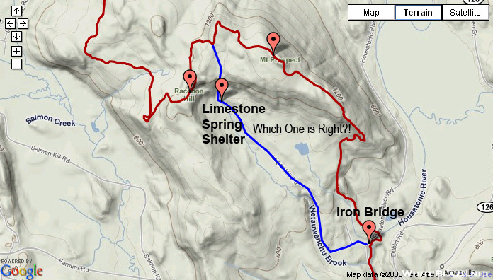
On this page, The Maroon Line represents the ESRI Data on the AT's Path. The Blue Line Represents the USGS Data on the AT's Path.
Just wondering which one is more recent, Any recent hikers go up Mount Prospect and Racoon Hill, or did you walk along SugarHill Road and pass the Limestone Spring Shelter. What do the NatGeo Maps Say? ATC? Guidebooks?
- Home
- Forum
- Journals
- Gallery
- What's New?
- Todays Posts
- 2,000 Miler Listing
-
Odd & Ends
- About WhiteBlaze/Tools
- About WhiteBlaze
- WhiteBlaze user agreement
- WhiteBlaze logo progression
- WhiteBlaze screen savers
- Purchase a banner spot
- Quick reference
- Usercp
- Subscribed Threads
- Members List
- Calendar
- Mark all forums read

 Reply With Quote