WhiteBlaze Pages 2024
A Complete Appalachian Trail Guidebook.
AVAILABLE NOW. $4 for interactive PDF(smartphone version)
Read more here WhiteBlaze Pages Store

Page 2 of 4 FirstFirst 1 2 3 4 LastLast
Results 21 to 40 of 68

Thread: Ruins?

  1. #21
    Registered User
    Join Date
    10-17-2007
    Location
    Michigan
    Age
    64
    Posts
    5,129

    Default

    We took a guided tour of some old homesteads in SNP when staying at Big Meadows Lodge - not hiking but the AT goes right through there. I think the far side of the meadow across the road. Note that all historic structures in SNP are protected and you can't camp near them.

  2. #22
    Registered User
    Join Date
    08-15-2012
    Location
    St. Petersburg, FL
    Age
    55
    Posts
    4

    Default

    Quote Originally Posted by canoe View Post
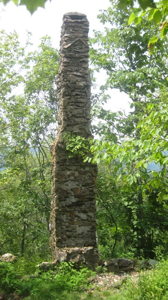
    In the northern section of the AT in SNP about mid way through the north section(near mathews arm) there is a full chimney and stone floor/harth. If I could figuire out how to post a pic I would post it.
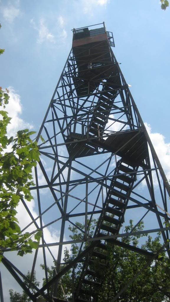
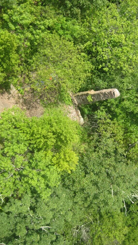
    The chimney is next to this tower.


  3. #23
    Clueless Weekender
    Join Date
    04-10-2011
    Location
    Niskayuna, New York
    Age
    68
    Posts
    3,879
    Journal Entries
    10

    Default

    Feral Bill is right that Harriman is full of ruins. Between the Elk Pen and Island Pond there's an abandoned 19th-century gravel pit, and the gravel sorter is still there, rusting away. There are lots of iron mine workings all through the park. The reason that the park service formally forbids bushwhacking is that people have drowned in abandoned mineshafts. The park also has the ruined village of Doodletown, The state burned the buildings some years ago because of recurrent problems with squatters, but the foundations and roads are still there, and there are even placards telling you what everything was. It's about a mile and a half east of the A-T. Easiest approach for a northbounder is probably to take the yellow-blazed Suffern-Bear Mountain trail down from West Mountain Shelter to the bridle path, turn right and take that into Doodletown, and then return to the A-T by the 1777W trail. (Or go out and back on the 1777W if you're a purist, but I'd not bother. The mile or so of A-T that you'd bypass isn't all that interesting.)

    The 1777W trail is part of the system that commemorates the Revolutionary War campaigns: it follows the route that part of the British army took to Fort Montgomery. (The 1777E trail, which divides from it at Doodletown, is the route the other group took to Fort Clinton.)
    I always know where I am. I'm right here.

  4. #24
    ME => GA 19AT3 rickb's Avatar
    Join Date
    12-12-2002
    Location
    Marlboro, MA
    Posts
    7,145
    Journal Entries
    1
    Images
    1

    Default

    You may want to google up Katahdin Iron Works.

  5. #25
    Registered User
    Join Date
    02-04-2013
    Location
    Washington, DC
    Posts
    4,316

    Default

    The remains of Rapidan Camp (President Hoover's old mountain retreat) in SNP isn't on the AT but is an interesting place to visit. A semi-loop can be made by using the Laurel Prong and Mill Prong trails although doing so will result in missing part of the AT in that area and some elevation loss and gain. Or out and back on either trail w/o missing any of the AT.

  6. #26

    Default

    Quote Originally Posted by DogPaw View Post
    I love working my way into abandoned structures, and I've been wondering if there are any things like these on the AT or one of the Florida trails.
    Some historical structures are headstones, and lots of historical artifacts are in cemeteries near the Florida Trail. Lewis Powell of the Confederate Secret Service was one of four conspirators hanged in D.C. for the Lincoln assassination plot. After death his severed head was stored at the Smithsonian until 1992. Head and body were eventually reunited in the Geneva Cemetery near the FT in Seminole County.
    http://www.findagrave.com/cgi-bin/fg...826964&df=all&

  7. #27
    Registered User
    Join Date
    06-01-2011
    Location
    Hendricks Cty, Indiana
    Age
    69
    Posts
    1,007

    Default

    AT Sept 2012 004.jpg
    Just 1/2 mile south of Kincora

  8. #28
    Registered User
    Join Date
    08-04-2011
    Location
    Philadelphia, PA
    Age
    70
    Posts
    55

    Default

    St Anthony's Wilderness in central PA has a stone tower and some ruins.
    http://www.midatlantichikes.com/stonetower.htm has a short description of it and the directions from the AT to the tower.

  9. #29
    ...Or is it Hiker Trash? Almost There's Avatar
    Join Date
    10-01-2005
    Location
    Woodstock, GA
    Age
    49
    Posts
    2,454
    Images
    17

    Default

    Is the Blair Witch House still there just south of VA42 in Sinking Creek Valley? Kind of neat to see.
    Walking Dead Bear
    Formerly the Hiker Known as Almost There

  10. #30
    Registered User hoffhiker's Avatar
    Join Date
    06-22-2013
    Location
    syracuse,ny
    Age
    42
    Posts
    14

    Default

    funny u mention RUNION i grew up in asheville nc and spent alot of my child hood going threw the ol town there was a church there when i was a kid when we went there when i was 15 the church was gettin ready to fall so we removen the stained glass window out of the front and restored it into a picture frame with my dad and five uncles highscool pics in it my grand ma still has the origonal glass

  11. #31

    Default

    In New Jersey, from south to north, and off the top of my head (in other words, this isn't a comprehensive list, and you should do more research):

    - Just after the crossing of the Delaware River from PA, the AT crosses the end of the Old Mine Road, which originally ran from Kingston, NY down to the Kittatinny Ridge that the AT follows in NJ.

    - A bit further along the trail, you intersect the Coppermine Trail, which leads down to the Old Mine Road, and along which some very old copper mines were located.

    - In the same general area off the AT, and down near the river, you can find some old experimental bore holes, plus cross-sections of 3 ft wide rock bore samples. These date from before the creation of the Delaware Water Gap National Recreation Area, when the Bureau of Reclamation planned to throw a dam across the Delaware Water Gap to create a reservoir and provide drinking water to Northern NJ. The bore holes were intended to determine if the rock underlying the Kittatinny Ridge were strong enough to hold back the pressure of the impounded water. (Fortunately, in my opinion, public pressure prevented the dame from being built).

    - Further up the AT, and 1 1/2 to 2 miles east of the trail, there's Millbrook Village, an authentic 18th - 19th century village that is open to wander through 7 days a week and has occasional staffing and displays on weekends. After leaving Mohican Center, passing a fire tower, and passing by Rattlesnake Swamp, at the first paved road you come to, you'd take a left.

    - About 5-6 miles further, in the area of Blue Mountain Lakes, you'll pass an area with a lot of cleared roads and pad sites. These were cleared by a developer in preparation for a planned vacation home community. The plans were scrapped and the land acquired by BLM through eminent domain in preparation for the DWG dam that never got built.

    - From there north for another 10 miles or so, you're within striking distance of Peters Valley, currently a fine crafts and arts center, but another community that was acquired through eminent domain for the dam. Throughout the area, there used to be a lot of small farms, farm villages, and rural buildings, but the BLM razed most of them as quickly as possible to prevent people from ever moving back in.

    - After leaving High Point, and before crossing Pochuck Mountain, the AT follows the outlines of a rectangle in the surface of the ground where there was an old mining/quarrying operation to extract very rich topsoil. The Lehigh New England also passed along one edge of this area, and it's now a part of the Walkill Valley National Wildlife Refuge.

    - In Vernon, just after you cross the boardwalk and the suspension bridge, and pass through a short segment of woods, you'll cross the old right of way of the Lehigh New England Railroad. There's a footbridge for the trail that crosses a stream, and it's built on old concrete supports that were used by the railroad.

    - After leaving the Walkill Valley in Vernon and climbing Stairway to Heaven, you'll enter Wawayanda State Park, which contains a number of old building sites and ruins.

    That's all I can recall at present.

  12. #32
    LT '79; AT '73-'14 in sections; Donating Member Kerosene's Avatar
    Join Date
    09-03-2002
    Location
    Minneapolis
    Age
    66
    Posts
    5,446
    Images
    558

    Default

    There is the foundation and chimney of an old hotel (I think) just off the AT south of McAfee Knob. Some of the Roanoke-based hikers will know what I'm referring to.

    Foundation of old summit houses can be found atop Mt. Moosilaukee, Mt. Lafayette, and Mt. Washington. There are a number of AT summits where you can still see the foundations of old firetowers that have been torn down.

    +1 on the side trip to Mt. Cammerer. It's worth it on a pretty day.
    GA←↕→ME: 1973 to 2014

  13. #33
    Registered User johnnybgood's Avatar
    Join Date
    11-28-2007
    Location
    Midlothian,Virginia
    Posts
    3,098
    Images
    76

    Default

    Quote Originally Posted by Kerosene View Post


    +1 on the side trip to Mt. Cammerer. It's worth it on a pretty day.
    205.jpg Here's a photo taken from the wrap around porch of Mt. Cammerer Fire Tower on a party cloudy day.
    Getting lost is a way to find yourself.

  14. #34
    Registered User Hikes in Rain's Avatar
    Join Date
    10-14-2005
    Location
    Georgia Mountains
    Age
    69
    Posts
    2,196
    Images
    23

    Default

    Cammerer Tower View.jpg

    A panoramic view from (I suspect) the same vantage point.

  15. #35

    Default

    There are a lot of stonework ruins along the C&O Canal, including the old Salty Dog Saloon just north of the pedestrian bridge on the east side of the river. If walls could speak...

    In the same area, between HF and I-70 are ruins of trenches and fortifications from the Battle of South Mountain. The action was at Crampton, Fox, and Turner Gaps, all on the AT. You have to look careful because it's so overgrown, but major battles happened here.

  16. #36

    Default

    Old, crumbling and probably dangerously collapsing lime kilns next to Lime Kiln Rd in Sheffield, Mass. 0.2 or so trail-north of Shays' Rebellion.

    Cosmo

    Quote Originally Posted by Snowleopard View Post
    1700s iron furnaces in CT and NY:
    Most of the forest in CT, MA, VT was cut down for charcoal to fuel industry in the 1700s. There are remnants of the 1700s steel industry:
    Kent, CT, Kent furnace http://www.ericsloane.com/museum.htm
    Salisbury, CT: Mt. Riga blast furnace, http://www.nynjctbotany.org/lgtofc/m...stfurnace.html
    Copake, NY (~10 miles or less from AT and on the south Taconic trail) has an 1845 blast furnace, Copake Iron Works,:
    http://www.flickr.com/photos/itinera...n/photostream/
    http://nysparks.com/parks/attachment...ndSchedule.pdf

    If you know what to look for there are many small quarries in New England. I've come across these in Brattleboro VT and Worcester, MA. You'd have to talk to local historical societies to find these.

    In New England there are many, many former factory buildings/mills from across the ages. The museum version would be the Lowell and Lawrence mills. Most of the towns near the AT in CT, MA, VT and NH would have these and most are abandoned or restored/renovated into something else. You could get in trouble (legal or injury) going into abandoned mills.

    There are a lot of little local history museums in the Berkshires that can be interesting.

  17. #37

    Default

    There's a whole side wall that was part of an inn or tavern somewhere south (?) of Iron Mansions hostel. You might like the Civil War Correspondent Memorial as well. I'm thinking this particular wall is somewhere between these two but that's a bit of distance.
    "Sleepy alligator in the noonday sun
    Sleepin by the river just like he usually done
    Call for his whisky
    He can call for his tea
    Call all he wanta but he can't call me..."
    Robert Hunter & Ron McKernan

    Whiteblaze.net User Agreement.

  18. #38
    Registered User Dr. Professor's Avatar
    Join Date
    10-31-2012
    Location
    Roanoke, Va
    Age
    48
    Posts
    212
    Images
    3

    Default

    Not on the trail, not exactly safe (so I can't recommend it), and I've never been there -- Centralia would be interesting to see.

  19. #39

    Default

    Quote Originally Posted by Dr. Professor View Post
    Not on the trail, not exactly safe (so I can't recommend it), and I've never been there -- Centralia would be interesting to see.
    Been there, and no the signs that are there say you are about to enter an area that is devoid of oxygen...or something like that. The vents that poke through the landscape can be seen spewing noxious gas and vapor....neat place though. Some good reading can be found on the Centralia PA mine fires.

  20. #40
    Registered User
    Join Date
    01-25-2013
    Location
    Upstate NY
    Age
    48
    Posts
    565

    Default

    Quote Originally Posted by Snowleopard View Post
    1700s iron furnaces in CT and NY:
    Copake, NY (~10 miles or less from AT and on the south Taconic trail) has an 1845 blast furnace, Copake Iron Works,:
    http://www.flickr.com/photos/itinera...n/photostream/
    http://nysparks.com/parks/attachment...ndSchedule.pdf
    And if you are on the AT and don't mind a "side trip" hike you could actually hike to this one via several other trails that connect the AT to the South Taconic trail.

Page 2 of 4 FirstFirst 1 2 3 4 LastLast
++ New Posts ++

Posting Permissions

  • You may not post new threads
  • You may not post replies
  • You may not post attachments
  • You may not edit your posts
  •